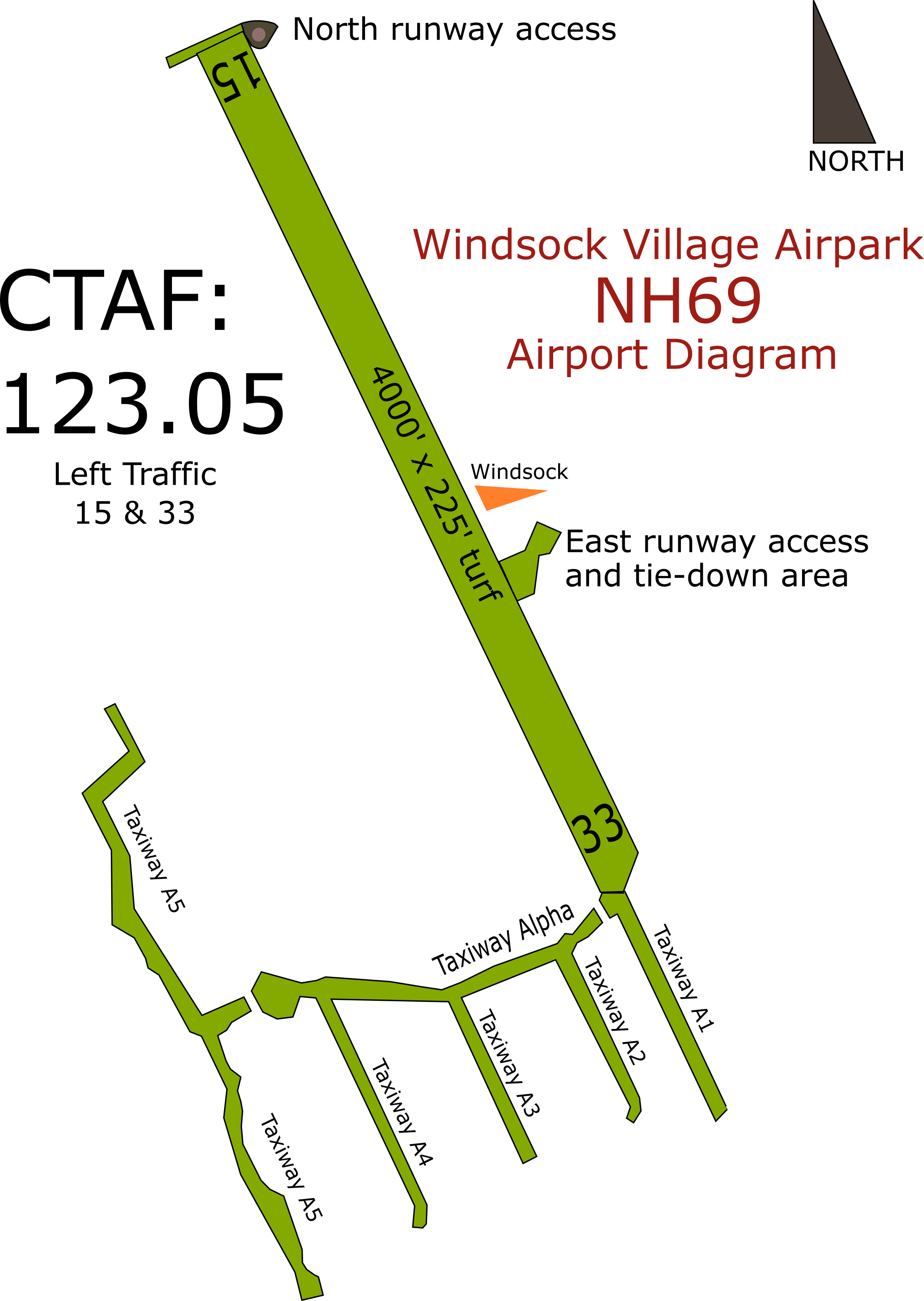
Runway Information
The runway at Windsock village has the FAA identifier of NH69 and is listed in most GPS databases. Note that the airpark is situated in valley most notably bordered by the Ossipee mountains to the southwest and Ossipee Lake to the southeast. The runway is surrounded by tall pine trees and is difficult to see when in the valley and below 2500 feet msl.
- Click here to display WIndsock Village Airpark in Google Maps
- Click here to display the Airnav page for Windsock Village Airpark
- Communications:
- CTAF: 123.05
- Pilot Controlled lighting: 123.05 (5 slow clicks)
- Weather:
- Click here for unofficial current Windsock weather
- Laconia (KLCI) AWOS: 133.525 (603-524-5134) – 18 miles SW
- Fryeburg (KIZG) AWOS: 135.775 (207-935-2882) – 14 miles NE
- Fuel: None
- Tie-downs: No public tie downs. Parking available mid-field on the east side – just south of the wind sock.
- Attended: No. You can leave a message at (207) 370-5168 or email to aviation@windsockvillageairpark.com. Normal response time is an hour or two.
- Caution:
- This is a residential airpark, be extra vigilant for people, pets and wildlife on the runway.
- Please make recommended radio calls if equipped and be advised that NORDO (no radio) operations are common.

